
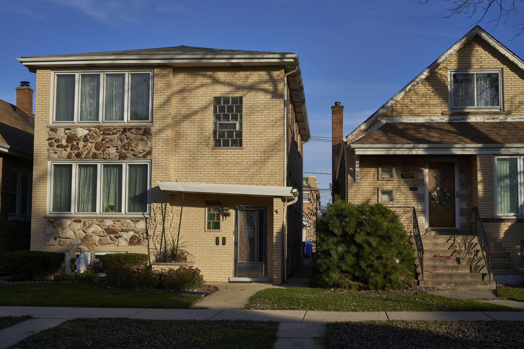
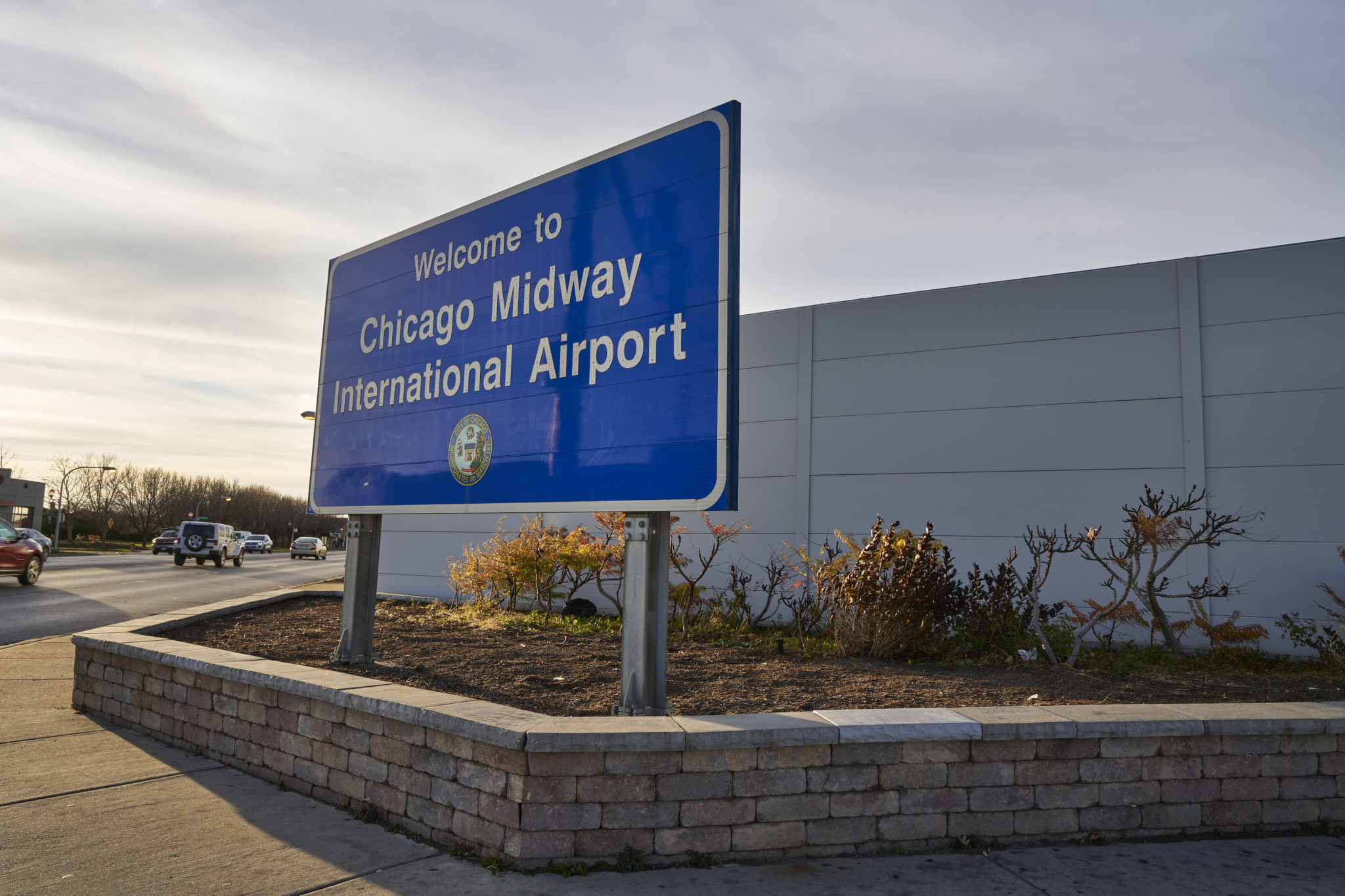
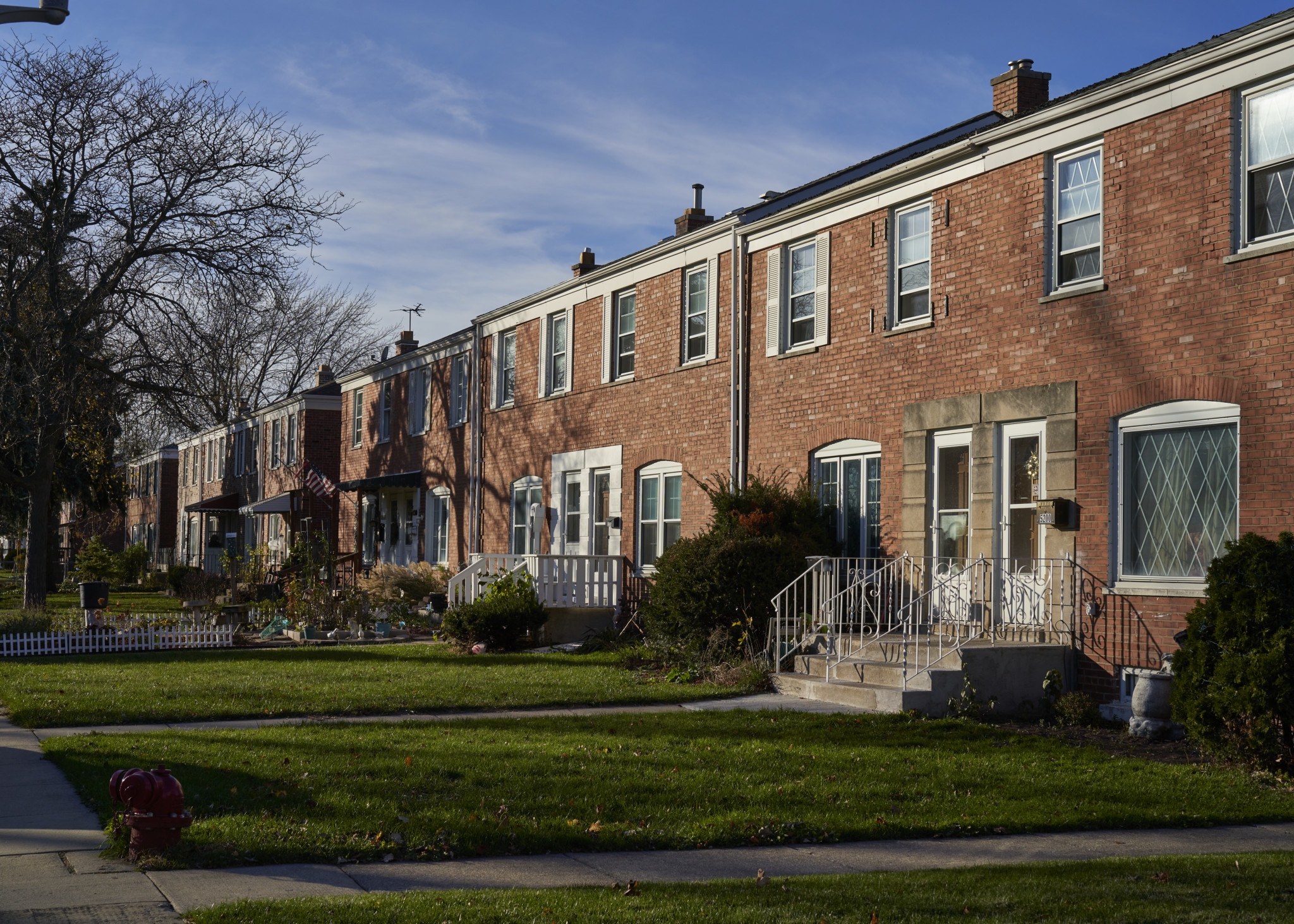
Clear-Ridge, the hyphenated moniker for the two outlying communities of Clearing and Garfield Ridge, is the perfect representation of the shared nature of both areas. Sticking out of the southwestern edge of Chicago, Clearing and Garfield Ridge not only share the once-busiest airport in the world, Midway, but share a common history.
Both were annexed to the city in 1915, much to the chagrin of what used to be Stickney Township. In fact, stories abound of political trickery, voter fraud, and lost paperwork regarding the annexation. Both also take their name from historical elements located in each community.
Clearing took the name from a great rail yard named the Chicago and Clearing Rail Yards, originally built by the railroad magnate A.B. Stickney and later bought by the Belt Line, which still owns it to this day. Garfield Ridge took its name from Garfield Boulevard, which runs through the community, and the ancient ridge that was originally a shoreline for the famous Mud Lake, which existed for thousands of years just north of what is now South 53rd Street.
Clear-Ridge has always been considered the “boonies” to old Chicagoans, and many longtime residents will regale you with stories about farms in the area through the 1950s. City utilities were slow to come to the community, as well as public parks (not until the late 1940s), and of course no “L” service existed until the Orange Line began operations in 1993.
This isolation came at a cost. While it helped shape the close-knit nature of both communities, it also contributed to segregation, as evidenced by the negative community response to the creation of the LeClaire Courts CHA development in the 1950s. While it was part of Garfield Ridge, the housing project remained highly segregated from the rest of the community until it was razed in the 2010s as part of their Plan for Transformation.
The moniker Clear-Ridge came into popular usage in the 1950s as the area, like most others, experienced a population boom. It’s been used as the name of the various local newspapers, most popularly the Clear-Ridge Reporter and its famous Little League, the Clear-Ridge Little League, which has won titles in the Little League World Series several times over the years.
Both communities are home to many city workers, especially police and fire department employees. Due to their proximity to the suburbs they offer residents the best of both worlds: city amenities as well as choices in eating and retail that the nearby suburbs offer.
While some rivalry does exist across the borders of Garfield Ridge and Clearing, you would be hard pressed to find anyone who doesn’t claim to have hung out, shopped, and lived their lives equally in both areas. Perhaps it is this close kinship that has helped form a sense of togetherness during the difficult months of the pandemic. Across both neighborhoods, local businesses and organizations have banded together to give people a sense of normalcy. (Rob Bitunjac)
Neighborhood Captain Rob Bitunjac, and his wife and three children, are lifelong residents of Garfield Ridge where their family has lived for the past hundred years. He has worked for the Chicago Public Library for the past twenty-nine years and is currently the branch manager for the Clearing Branch Library. In 2011, along with a group of other local historians, he formed the Clear-Ridge Historical Society and has served as the president since its inception. The Clear-Ridge Historical offers tours, free programs at the Clearing Library, has written three books on local history, and maintains a local history file at the Clearing Library.
Best Rock Group
Clear/Ridge Rocks
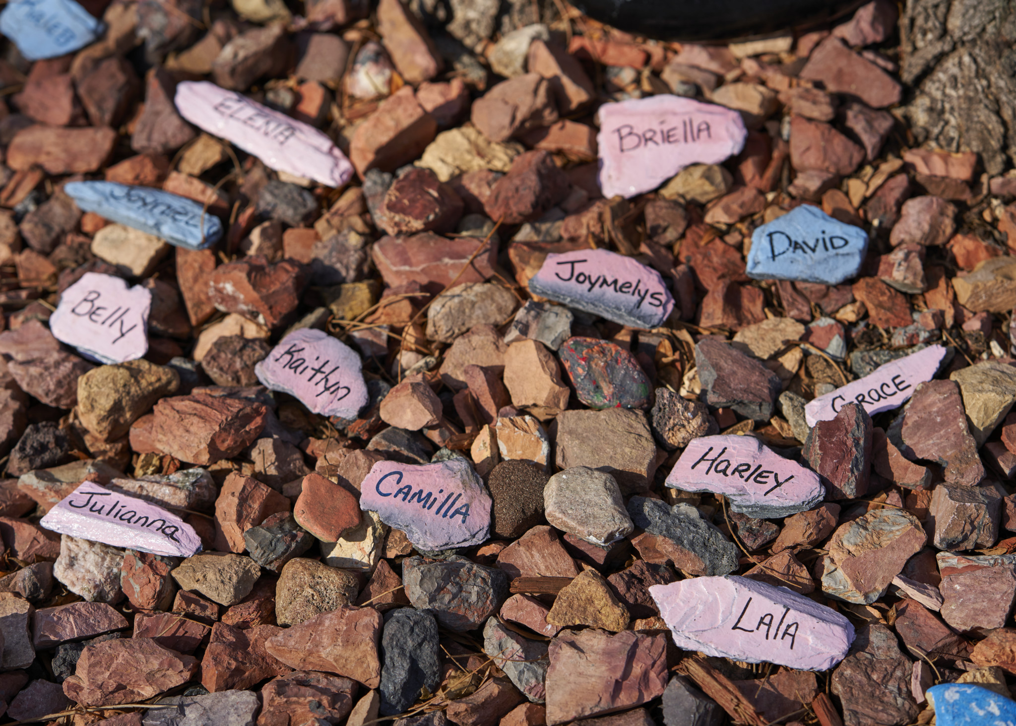
Kerry Gollogy loves rocks—but no, she’s not a geologist. She was in Florida with her son and came across a painted rock. It made her smile. Instructions on the rock directed her to a Facebook group that encouraged her to rehide the rock for someone else to find. She immediately thought that this would be a great idea for her neighborhood of Clearing and Garfield Ridge. Along with her friend Lisa Robinson, she set up a Facebook group called Clear/Ridge Rocks this June.
The idea is for people to paint or otherwise decorate rocks, hide them, and encourage anyone that finds the rock to post a picture on the Facebook group and either rehide it or paint a new one. The idea took off, and the group currently has 2,200 members.
Why is it so popular? “I think people needed something to make them smile in these times,” said Gollogy. “Talking and walking and looking down and seeing a rock makes you feel happy. People are getting out of the house, it makes walks more enjoyable. It’s a small act of kindness that is so important right now. I have met neighbors that live on my block that I was unaware of. It gives everyone a little bit of hope. Also, kids love to paint and create.”
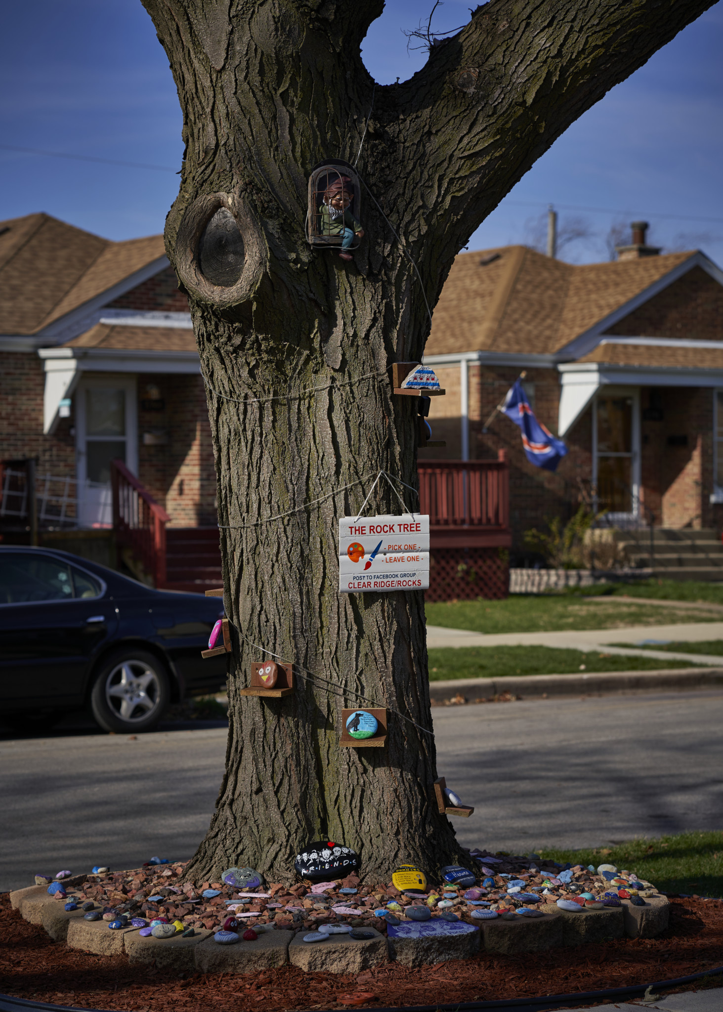
And it’s not only kids that are enjoying the site. It has brought out the artistic talents of many adults in the area that just love to paint and hide rocks for the kids to find. A frequent contributor, Jennifer Lody, said that painting the rocks is therapeutic and that she loves seeing the ideas that others have come up with. They have even created “Rock Trees” where people can hide their rocks and display their ideas. Another member, Dave Koz, is known for his rocks painted like mice, and people fight to find them.
In these times of social distancing and quarantine, this has proven to be a perfect activity for the whole family. (Rob Bitunjac)
Clear/Ridge Rocks. facebook.com/groups/289418702442031
Best Public History
Chrysler Village
Most lifelong Chicagoans are aware that the city is laid out along a giant grid. Map enthusiasts and amateur and professional historians are often interested in deviations from this grid because these anomalies tell small stories about the development of the city. Whether it be a diagonal street or an oddly shaped group of streets, these breaks in the grid never cease to pique curiosity.
So it is no surprise that within the outlying community of Clearing, there lies an oval-shaped subdivision that catches the attention of most of these folks.
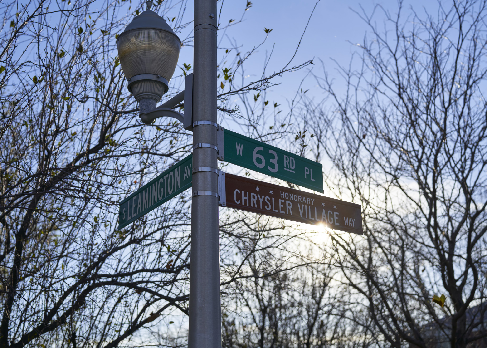
Unofficially called Chrysler Village, this subdivision is located near the southeast corner of Clearing, bounded by West 63rd and 65th Streets and South Long and Lavergne Avenues. It was designed in the 1940s by the J.E. Merrion Company, which later lent its name to the southwest suburb Merrionette Park.
Built primarily for World War II-era workers who were employed by the nearby war defense plants—the Dodge Plant (which became the shopping mall Ford City) just to the southwest, and the Studebaker Plant to the north near Archer and Cicero Avenues—the houses of this subdivision, largely underwritten by the Federal Housing Administration and originally subject to restrictive racial covenants, have a utilitarian style. The homes are distributed in an oval shape, forming a ring with Lawler Park at its center. The semicircular street layout has given rise to conspiracy theories about a covert military meaning behind its design and rumors of underground tunnels to Midway Airport and Ford City Mall.
The circular layout also fostered a close-knit community. Former and current residents recall giant block parties and neighborhood events centered at Lawler Park. People who lived there used to distinguish themselves as being from “the village,” as opposed to the rest of the Clearing community. Over time, as the defense plants closed, residents no longer shared a common workplace but the close-knit community feeling persisted.
In 2014, at the urging of 13th Ward Alderman Marty Quinn, and with the help of residents and a group of doctoral students at Loyola University Chicago’s Public History Lab, Chrysler Village was named to the National Register of Historic Places. A community event was held in August 2016 celebrating past and present residents along with activities, history booths, an oral history project, and an honorary “Chrysler Village Way” street sign unveiling. Current residents are proud to be part of a historic place and many have purchased plaques that adorn their residences and attest to the historic importance of the community. (Rob Bitunjac)
Chrysler Village, bounded by W. 63rd St. to the north, S. Lavergne Ave. to the east, W. 65th St. to the south, and S. Long Ave. to the west. To find out more about the area and the Chrysler Village History Project, visit chryslervillageproject.wordpress.com.